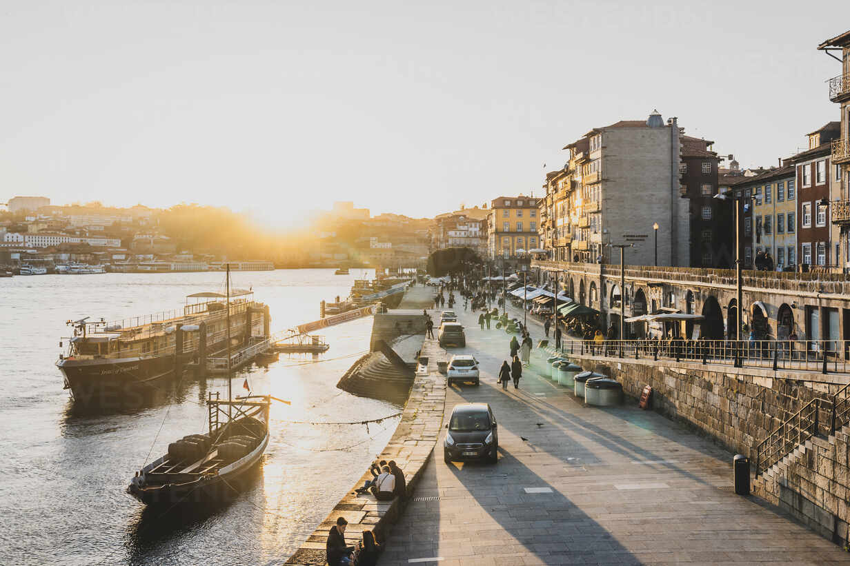
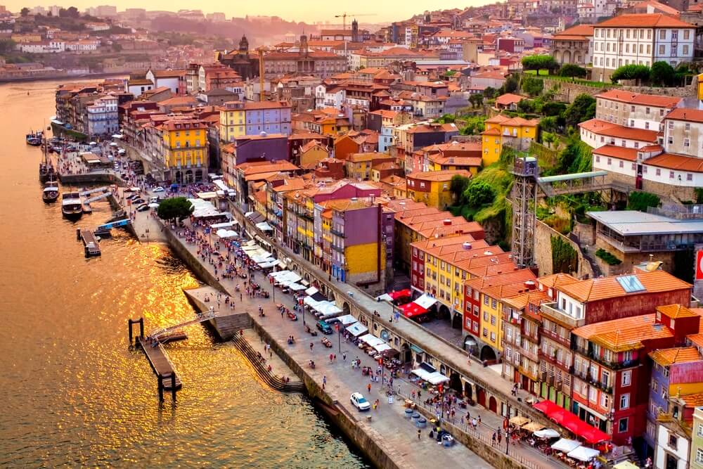
Ribeira is one of the oldest and most typical places in the city of Porto, in Portugal. Located in the parish of São Nicolau, next to the Douro River, it is part of the Historic Center of Porto, a UNESCO World Heritage Site.
History
It is not known when the current Ribeira area began to be inhabited. It is known that the original nucleus of Porto developed at the top of Pena Ventosa, the current Morro da Sé, but that a riverside cluster also soon developed, close to the confluence of the small Rio da Vila with the River Douro. Archaeological remains document that, during the period of Romanization, port facilities were created near the place where the Casa do Infante later stood, whose Roman mosaics date back to the 4th century. At a time when the upper area was already protected by Cerca Velha.
After the troubled period of Muslim invasions and reconquest, in 1120 D. Teresa donated the Couto de Portucale to D. Hugo, bishop of Porto. The vagueness of the limits of the couto to the west (Rio da Vila or Rio Frio) fueled numerous conflicts between the king and the bishop, only resolved in 1406 when the city’s lordship
definitively passed from the church to the crown.The 13th century represented a period of expansion in which Porto grew, including the foot of the Pena Ventosa escarpment, close to the riverbank. Houses, streets, stairs and alleys developed, such as Rua da Lada. On the right bank of the Rio da Vila, the town grew along the São Nicolau riverfront, Rua da Reboleira and
Rua dos Banhos, eventually reaching the “outskirts” of Miragaia. Thus, two settlement centers emerged—one in the upper zone, on the Pena Ventosa hill, around the cathedral, and the other in the lower zone, in Ribeira, along the banks of the Douro—connected by an urban network that became more dense.The oldest axis that connected the two clusters ran along Rua de D. Hugo, through Porta das Verdades (da Cerca Velha) and Escadas do Barredo, following the shortest route, but with a very steep slope. Later, another axis with better accessibility was developed, consisting of Ruas dos Mercadores, Bainharia and Escura, connecting to Porta de São Sebastião.
Throughout the 14th century, Porto saw a great expansion of settlement along the riverbank of the Douro, reflecting the growing importance of commercial and maritime activities. The city therefore felt the need for a walled space larger than that of the Cerca Velha, which only protected the Cathedral block. A new fence was built, currently called Muralha Fernandina because, despite being started with D. Afonso IV, the its great driving force, it was only completed during the reign of D. Fernando.
In the last decade of the 14th century, and on the initiative of D. João I, Rua Nova began to be opened, a street that contrasted with the labyrinthine medieval Porto. With a straight layout, considered long and wide at the time, it was a prestigious location that attracted the construction of luxury buildings to house the bourgeois elite and clergy and centralized the life and business of merchants. Rua Nova (today Rua do Infante D. Henrique) took around a hundred years to complete. As it connected Rua dos Mercadores to the Convent of São Francisco, it constituted an important circulation axis parallel to the riverbank.
At the beginning of the 15th century, Ribeira was teeming with people linked to the multiple activities of the river and the sea, the domain of merchants and generator of bourgeoisie, with the center in Praça da Ribeira and expanding towards Rua Nova. In 1491, a violent fire consumed most of the houses in Praça da Ribeira and the surrounding areas. From 1521, on the king’s initiative, Rua de Santa Catarina das Flores, now Rua das Flores, began to be opened, through the bishop’s and chapter’s gardens and on Misericórdia lands, facilitating
access from Praça da Ribeira to Porta de Carros (of Muralhas Fernandinas), next to the Convent of São Bento da Avé-Maria, north exit of the city.Two centuries later, João de Almada e Melo was responsible for an urban plan for the city of Porto—one of the first comprehensive plans in Europe. Praça da Ribeira was changed, Rua de São João was opened, improving access from Ribeira to the highest area of the city which, until then, was mainly via Rua dos Mercadores.
The second half of the 18th century was also the time for the construction of large buildings representing English-influenced neoclassical architecture, which continued into the 19th century. Examples are, in the Ribeira area, the Palácio da Bolsa, the Casa da Feitoria Inglesa, the buildings on the west side of Praça da Ribeira, the Church of the Thirds of São Francisco and the open arches in the “Muro da Ribeira”, to facilitate access to the river. This arcade was inspired by the Adelphi galleries, old warehouses in London’s port area that were eventually demolished to make way for the Victoria Embankment.
Despite all the transformations that Porto, as a whole, went through at the end of the 18th century, the city remained facing the Douro, living according to the river, with the economic and social center nearby – Praça da Ribeira, Rua Nova dos Ingleses, Rua de São João and Largo de São Domingos. Images from the time, depicting the river covered in ships, suggest the importance of intense commercial traffic.
The 19th century in Porto was marked, right from the beginning, by situations of political instability such as the French invasions. In 1809, the Ponte das Barcas tragedy occurred in Ribeira, remembered by the Alminhas da Ponte, with a bas-relief by Teixeira Lopes, father, placed at Cais da Ribeira. In the 1830s, it was the liberal wars, which culminated in the Siege of Porto, in 1832-1833, which caused destruction in the old city, especially in the lower riverside area and on the surrounding slopes.
But the second half of this century presented periods of great dynamism. In 1885 Praça do Infante was opened and the Ferreira Borges Market was built. This intense phase of urban expansion appears within a context of strong demographic growth, the attraction of populations from the rural world and economic transformations, particularly the growing importance of industrial activities. Demographic pressure in Ribeira continued to increase without ceasing.
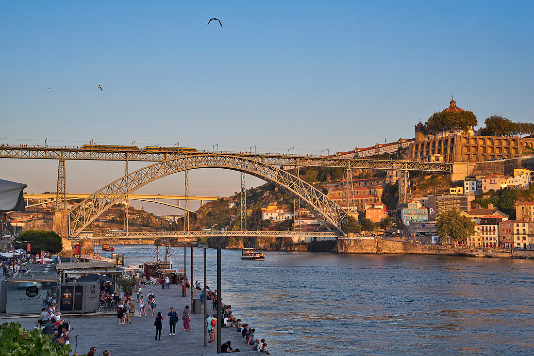
The reorganization of Porto’s urban structure in the 19th century was also greatly conditioned by the revolution in circulation infrastructure. For crossing the Douro River, throughout this century, there was the Ponte das Barcas, inaugurated in 1806; a suspension bridge, the D. Maria II Suspension Bridge, in 1843; and, in 1886, the Luís I Bridge, with the novelty of having a second deck at high elevation, eliminating the mandatory passage through Ribeira for traffic coming from the south. In the old town, in the second half of the 19th century, there was an important reorganization of traffic routes with the opening of new streets, namely Rua de Mouzinho da Silveira (1872), a new, wider and straighter axis connecting Rua Nova dos Ingleses (Rua do Infante D. Henrique) to the Convent of São Bento da Avé-Maria.
The profound changes in Porto life during the 19th century caused the progressive displacement of the center of the city’s social, political and business life from the Ribeira and São Domingos area to Praça Nova and its surroundings, which acquired increasing importance. As a consequence, the headquarters of companies, insurance and banks, linked to the mercantile and financial bourgeoisie, also seek to install themselves next to new streets with better accessibility (Rua Nova da Alfândega, Rua de Ferreira Borges, Rua de Mouzinho da Silveira) to the center emerging. From a social and demographic point of view, we are witnessing the gradual transfer of rich families to larger and more pleasant locations; and housing over-occupancy, accelerated by the growing influx of rural people attracted by the dawn of industrialization, resulting in an accelerated degradation of hygienic and health conditions in Ribeira, particularly in the neighborhoods of Lada and Barredo. Finally, the construction of an artificial port in Leixões in 1895, which was expanded throughout the 20th century, ended up definitively marginalizing this historic area, leading it to gradual decay and degradation.
However, from the mid-1970s onwards, largely thanks to initiatives developed by the Commissariat for Urban Renewal of the Ribeira/Barredo Area (CRUARB), an ambitious plan for the recovery and revitalization of Ribeira do Harbor. The activity carried out by CRUARB was also decisive in the presentation of the candidacy of the Historic Center of Porto to UNESCO for classification as Cultural Heritage of Humanity, in 1991. As part of this renaissance of Ribeira, numerous bars and restaurants were opened, making it a point meeting place for nightlife.